Revolutionizing Disaster Management and Tracking with Building Information Modeling (BIM)
Tweet
Natural disasters have consistently posed significant challenges to humanity, causing loss of life, property, and environmental damage. These events demand comprehensive, agile, and technology-driven approaches for mitigation, preparedness, response, and recovery efforts.
In recent years, Building Information Modeling (BIM) has emerged as a transformative tool in disaster management and tracking. BIM, initially used in the construction and architecture sectors, is now proving to be invaluable in enhancing disaster resilience, response, and recovery. This article delves into the applications and benefits of BIM in the realm of natural disasters and tracking.
BIM as a Digital Twin
Building Information Modeling (BIM) can be understood as a digital twin of the physical environment. It is a holistic, dynamic representation that mirrors real-world structures, systems, and spaces. BIM encompasses not just the visual aspects but also the functional and behavioural characteristics of buildings and infrastructure.
BIM's Holistic Data Approach
BIM is more than just a 3D modelling tool; it is a holistic approach to data management. It integrates architectural, structural, mechanical, and electrical information into a unified digital platform, fostering collaboration and enabling informed decision-making throughout a project's lifecycle.
BIM in Disaster Preparedness and Mitigation
The key to disaster management is effective preparedness and mitigation efforts. BIM plays a pivotal role in this phase by enhancing the understanding of the built environment and enabling proactive measures. Here's how BIM contributes to disaster preparedness and mitigation:
a. Risk Assessment: BIM helps experts identify vulnerable structures and assess potential risks by providing a detailed representation of the built environment. It allows for the integration of historical data, climate information, and geographical data to identify areas susceptible to specific hazards such as earthquakes, floods, or hurricanes.
b. Evacuation Planning: During disasters, timely evacuation is crucial. BIM models can assist in creating evacuation plans by simulating disaster scenarios and identifying safe routes and assembly points. Real-time data can also be incorporated to adjust plans as the situation evolves.
c. Structural Analysis: BIM facilitates structural analysis and simulation, which is essential for evaluating the performance of buildings and infrastructure under various disaster conditions. Engineers can use BIM to test the resilience of structures and suggest modifications to enhance their safety.
d. Resource Allocation: BIM assists in optimizing resource allocation by providing a comprehensive view of available assets and their locations. This is critical for ensuring that response teams have the necessary equipment and personnel in place before disasters strike.
BIM in Disaster Response
When a natural disaster occurs, rapid and well-coordinated response efforts are vital. BIM's capabilities are instrumental in streamlining disaster response operations:
a. Damage Assessment: BIM models, combined with remote sensing technologies like drones and satellites, allow for rapid and accurate damage assessments. Response teams can identify the extent of damage, prioritize areas in need of immediate attention, and allocate resources efficiently.
b. Resource Coordination: BIM facilitates real-time resource coordination by providing a shared platform for all stakeholders, including emergency responders, government agencies, and relief organizations. This fosters collaboration and ensures that resources are deployed where they are most needed.
c. Rescue Operations: BIM's 3D modelling capabilities assist in planning and executing complex rescue operations, especially in urban environments. Rescuers can visualize building layouts, access points, and potential hazards, making their operations safer and more effective.
d. Communication: BIM serves as a central hub for communication during disaster response efforts. Information about casualties, trapped individuals, and changing conditions can be updated in real time and shared among response teams.
BIM in Disaster Recovery and Reconstruction
After a disaster, the road to recovery and reconstruction can be long and challenging. BIM continues to play a crucial role in these phases:
a. Damage Documentation: BIM models serve as a comprehensive record of the pre-disaster built environment. This documentation is invaluable for insurance claims, assessing damage for regulatory purposes, and ensuring that reconstruction efforts accurately replicate the original structures.
b. Planning and Design: BIM facilitates the planning and design of reconstruction projects. Architects and engineers can use existing BIM models as a starting point, making the design process more efficient and accurate.
c. Cost Estimation: Accurate cost estimation is vital for securing funding for reconstruction projects. BIM's data-rich models enable detailed cost analysis, helping stakeholders determine budgets and secure necessary resources.
d. Quality Control: During reconstruction, BIM ensures that the work is carried out according to design specifications. It provides a reference point for quality control checks and helps identify deviations from the original plans.
Case Studies: BIM in Disaster Management
To illustrate the real-world applications of BIM in disaster management and tracking, let's explore a few case studies:
a. Hurricane Katrina (2005): In the aftermath of Hurricane Katrina, BIM was employed to document the extensive damage to New Orleans' infrastructure. This data facilitated the planning and execution of reconstruction projects and allowed for accurate assessments of the cost and scope of the recovery efforts.
b. Nepal Earthquake (2015): Following the devastating earthquake in Nepal, BIM was used to assess the structural integrity of heritage buildings. The 3D models created helped in planning restoration efforts and preserving cultural landmarks.
c. California Wildfires (Ongoing): BIM is being used to assess and document the damage caused by wildfires in California. This data aids in the planning of rebuilding efforts and ensures that structures are constructed to be more resilient to future fires.
Challenges and Future Directions
While BIM has demonstrated its potential in disaster management and tracking, several challenges and opportunities lie ahead:
a. Data Integration: Integrating diverse data sources into BIM models remains a challenge. Future developments in data interoperability standards will enhance BIM's effectiveness.
b. Accessibility: Not all regions and organizations have access to BIM technology. Efforts to make BIM more accessible and affordable are crucial.
c. Training and Education: Widespread adoption of BIM requires a skilled workforce. Investing in training and education programs for professionals is essential.
d. Continual Improvement: BIM technology is continually evolving. Staying up-to-date with the latest advancements is essential for maximizing its benefits in disaster management.
e. Cybersecurity: Protecting BIM data from cyber threats is paramount, given the sensitive nature of disaster management information.
To get online demonstration, watch the following video tutorial.
Video Source: Autodesk Construction Cloud
Conclusion
Building Information Modeling (BIM) has emerged as a game-changer in disaster management and tracking.
Its ability to create detailed digital representations of the built environment, integrate data from various sources, and facilitate collaboration among stakeholders has proven invaluable in disaster preparedness, response, and recovery efforts.
By harnessing the power of BIM, we can enhance our resilience to natural disasters, minimize damage, and accelerate recovery processes. As technology continues to advance and BIM.
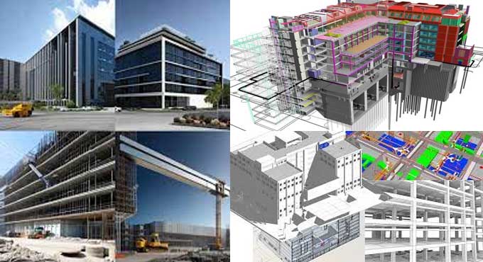
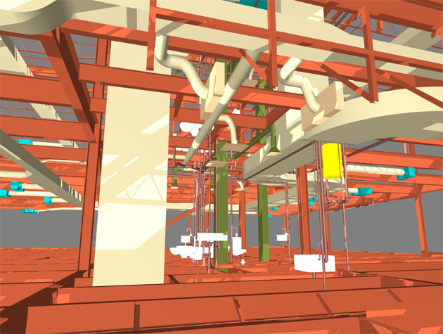
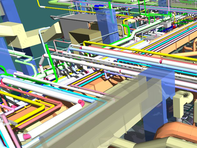
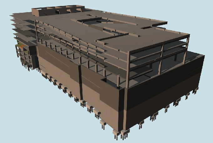
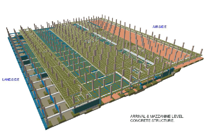
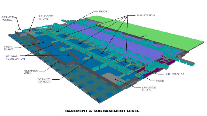
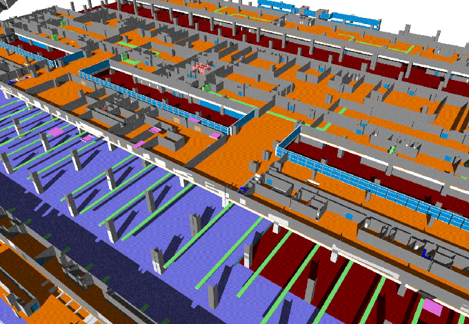
Gallery
Feel free to contact us for BIM requirements. One of our representative will respond you within 24 Hours. Send us your projects requirement today and grow your project.
Explore More !