Harnessing Synergy: BIM Integration with GIS for Comprehensive Disaster Mapping and Data Visualization
Tweet
Natural disasters, from earthquakes and hurricanes to floods and wildfires, have a profound impact on communities worldwide. Effective disaster management demands accurate and up-to-date information for planning, response, and recovery efforts.
In this digital age, the integration of Building Information Modeling (BIM) with Geographic Information Systems (GIS) has emerged as a powerful solution for comprehensive disaster mapping and data visualization. This article explores the synergy between BIM and GIS and its transformative potential in disaster management.
Understanding BIM and GIS
Before delving into their integration, let's first understand the core concepts of BIM and GIS:
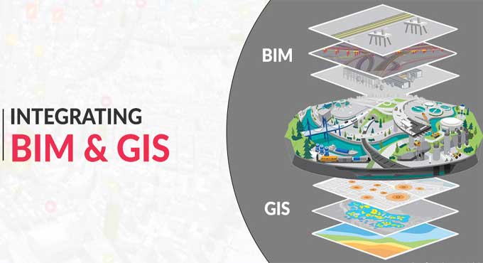
Building Information Modeling (BIM): In BIM, the physical and functional characteristics of a building are represented digitally. It encompasses 3D models, spatial relationships, quantities, and properties of building components, offering a holistic view of structures. BIM is widely used in architecture, engineering, and construction for design, construction, and facility management.
Geographic Information Systems (GIS): GIS is a technology that captures, stores, analyzes, and visualizes geospatial data. It combines maps, data tables, and spatial analysis tools to link information to locations on the Earth's surface. GIS is used in various fields, including urban planning, environmental management, and disaster management.
The Need for Integration
Natural disasters often transcend the boundaries of individual buildings and affect entire regions. To effectively manage disasters, it is crucial to integrate data from both BIM and GIS:
Spatial Context: GIS provides the spatial context necessary for disaster management. It offers information on geographical features, terrain, land use, and population distribution, enabling responders to understand the broader impact of a disaster.
Building-Specific Data: BIM, on the other hand, offers detailed data about individual structures, including architectural, structural, and mechanical information. This is invaluable for assessing damage, planning evacuations, and coordinating response efforts.
Integration: The integration of BIM and GIS combines the spatial context of GIS with the building-specific data of BIM, providing a comprehensive and accurate view of the disaster's impact on both infrastructure and geography.
Benefits of BIM-GIS Integration in Disaster Mapping
The integration of BIM and GIS offers several key advantages in disaster mapping and data visualization:
a. Accurate Damage Assessment: By combining BIM's building-specific data with GIS's spatial context, responders can accurately assess the extent of damage to individual structures and their impact on the surrounding environment.
b. Resource Allocation: GIS data aids in resource allocation by showing the location of critical infrastructure, emergency shelters, and medical facilities. BIM complements this by providing details about the condition and capacity of these structures.
c. Evacuation Planning: GIS can identify evacuation routes and assembly points based on geographical data, while BIM can provide interior layouts and accessibility information to ensure efficient evacuations.
d. Real-Time Data: BIM-GIS integration allows for the incorporation of real-time data sources, such as weather updates and social media feeds, to provide responders with the latest information during a disaster.
e. Improved Decision-Making: The combined data from BIM and GIS empowers decision-makers with a comprehensive understanding of the disaster's impact, enabling more informed and effective responses.
Integration Approaches
Several approaches can be used to integrate BIM with GIS for disaster mapping:
a. Data Linking: This approach involves creating links between BIM and GIS datasets. When changes occur in one dataset, they can be reflected in the other. This method ensures data consistency but may require additional effort to maintain the links.
b. Data Conversion: In this approach, BIM data is converted into a GIS-compatible format. While it simplifies data sharing, it may lead to data loss or inconsistencies if not done carefully.
c. Web Services: Web services and APIs (Application Programming Interfaces) enable real-time data exchange between BIM and GIS platforms. This approach offers flexibility and scalability but may require technical expertise.
d. Common Data Environment (CDE): Establishing a CDE that can store both BIM and GIS data ensures a centralized repository for information sharing. This approach facilitates collaboration among stakeholders.
Real-World Applications
Let us explore how BIM-GIS integration has been applied in real-world disaster management scenarios:
a. Earthquake Preparedness and Response: In earthquake-prone regions, BIM-GIS integration is used to assess the vulnerability of buildings and infrastructure. By simulating earthquake scenarios, responders can identify high-risk areas and plan for immediate response.
b. Flood Risk Assessment: GIS data is used to map flood-prone areas, while BIM data aids in assessing the structural integrity of buildings in these zones. During a flood, responders can prioritize evacuation efforts based on this information.
c. Wildfire Management: In wildfire-prone regions, GIS helps identify areas at risk, while BIM data is used to assess the vulnerability of structures. This integrated approach ensures a coordinated response to protect lives and property.
d. Hurricane Planning: BIM-GIS integration is crucial in hurricane-prone coastal regions. It helps in planning and managing evacuation routes, shelters, and emergency services, considering both building-specific and geographical data.
e. Post-Disaster Reconstruction: After a disaster, BIM-GIS integration assists in documenting damage, assessing reconstruction needs, and tracking progress. It ensures that new structures are resilient and aligned with the surrounding environment.
Challenges and Considerations
While the integration of BIM and GIS offers immense potential, several challenges and considerations must be addressed:
a. Data Standardization: Ensuring that BIM and GIS data adhere to common standards is essential for smooth integration.
b. Data Privacy: Protecting sensitive information in both BIM and GIS datasets is paramount, especially when sharing data with multiple stakeholders.
c. Technical Expertise: Implementing and maintaining integration solutions may require specialized technical skills and resources.
d. Cost: Integrating BIM and GIS can involve initial costs for software, training, and infrastructure.
e. Interoperability: Ensuring that BIM and GIS software are compatible and can communicate effectively is crucial.
Future Directions
The integration of BIM and GIS for disaster mapping is poised for further advancements:
a. IoT Integration: The Internet of Things (IoT) can enhance data collection by providing real-time information from sensors placed in buildings and infrastructure.
b. Machine Learning and AI: These technologies can analyze integrated data to predict disaster impacts and optimize response strategies.
c. Cloud-Based Solutions: Cloud computing can facilitate data sharing and collaboration among stakeholders, making BIM-GIS integration more accessible.
d. Mobile Applications: Mobile apps can empower responders with integrated BIM-GIS data in the field, improving situational awareness.
e. Global Standards: The development of global standards for BIM-GIS integration can promote consistency and interoperability.
To get online demonstration, watch the following video tutorial.
Video Source: Esri Events
Final Thoughts
The integration of Building Information Modeling (BIM) with Geographic Information Systems (GIS) is a game-changer in disaster mapping and data visualization.
By combining detailed building-specific data with the spatial context of geographical information, this synergy empowers responders and decision-makers with comprehensive insights during disasters.
As technology continues to advance and as organizations recognize the potential of BIM-GIS integration, we can expect more effective disaster management strategies, quicker response times, and enhanced resilience in the face of natural disasters. This transformative approach exemplifies the power of collaboration between different fields to address some of the world's most pressing challenges.
Gallery
Feel free to contact us for BIM requirements. One of our representative will respond you within 24 Hours. Send us your projects requirement today and grow your project.
Explore More !